A’ight, so my brother and I ran the GORUCK Star Course 50-Miler in Philly over the weekend. Team Sloth, @teamslothgoruck on Instagram. Here’s the rough timeline of relevant stuff, with miscellaneous asides thrown in when relevant.
But first, here’s Steve with his intro – he had to fly out to London for work 8AM the morning after, so we’re going back and forth writing this over email:
Big picture background: Who are we?
Ahem.
Most people reading this probably don’t know who we are, so let’s start with an introduction of sorts.
We got started with this whole endurance activity thing about five years ago, with Light 002 in DC. After that, did another 5 Lights and 3 Challenges over roughly the next year and a half. Haven’t done a GORUCK rucking event since 2014 (if I remember correctly). At that point, I started getting more into running. One of my friends wanted to run the MCM in 2014, so I started training more for that. As part of training for that, I ran a 50k, and it sort of snowballed from there.
Don joined me in 2016 as part of a bet (he wanted a fancy Ministry of Supply suit made out of athletic-clothes material, but didn’t want to pay, so I said I’d get it for him if he ran an ultra in it) and since then he’s run all the races I have. That’s been give or take two dozen ultras. We’re solidly middle-of-the-pack, depending somewhat on the distance. Sometimes we’re closer to the front, sometimes not. We’re still new to the whole ultra scene, and we generally finish higher in shorter races than longer ones.
Don’s won his age group in one 50k (Don’s note: C’mon, dude, the two of us made up 2/3rds of that age group, and you had to stop at the turnaround point to MacGuyver up an IT brace.) and usually does better than I do (very debatable). He’s also won or placed in several shorter (and very local… I’ll stop now) OCRs.
My strengths are nighttime races and 50-milers/12-hour races, with my best finish being 4th and winning a literal backpack full of beer. We’ve only run one team race before, a sort of obstacle-course-ish race; we won by seconds thanks to the last obstacle being a puzzle.
Steve on the Star Course itself:
We decided to do the Star Course in June. When we signed up, there had only been two, and we didn’t know anything about finishing times or anything like that. Although we’ve done some rucking events, most of our background is in ultrarunning, so that’s how we approached the event. We trained individually over the summer, wearing our rucks for runs once every week or two to get a feel for how it impacts everything. Initial results were that it caused about a 2-minute-per-mile hit to pace, at distances up to a half-marathon.
In September, we ran a 12-hour trail race with rucks to get a feel for the weight at a longer distance. We ended up completing ~45 miles in about 11:50. Based on our training, we were targeting something in the 12-hour range for a finishing time. We figured we’d be a bit faster at the Star Course than the training race, due to it being an actual race and probably a slightly easier route (road vs single-track), but as it’d be at night we’d be slowed down a little bit, so a lot was up in the air.
Because the route was so important, I started looking at route-finding tools. Everything I saw was aimed at driving; there wasn’t anything that was available to figure out the optimal walking directions for a route like the one we’d need to find.
While working on figuring out the route finding aspect, I checked out a couple AARs. In the two that listed the first-place times (DC and Denver, I think), the winning team finished somewhere around 12 hours. This made a lot of sense. In both cases, the second-place finish was several hours behind.
Back to route-finding. I didn’t see anything about finding an optimal walking route, so I ended up tossing together a custom tool based on Google Maps. It’s currently up at astronav.drunkenrobotlabs.org (although I can’t guarantee it’ll always be up or always be 100% functional). Basically it just asks Google for the optimal walking route, which is something that they fully support but that (as far as I can tell) isn’t directly accessible through any of their tools.
It’s far from perfect, due to (1) GMaps not actually being that great when it comes to knowing where addresses are (this is something I’ve encountered in other projects, as well, not just this), (2) GMaps not always knowing where I’m willing to walk or not (not in the sense of sending me through the ghetto, I don’t mind that; I mean we managed to cut ~5 miles off its given route due to being willing to wade along a stagnant stream and then jog in the shadows next to some train tracks), and (3) it doesn’t take into account routes that are only open at certain times (as will be discussed more below).
Anyway, with our training done and our tool in hand, we had our crew (i.e., Dad) drive us to Philly.
1900… ish: Team Sloth arrives at the start point, Paine’s Park. Don’t see Cadre, but we have spied one or two small bands of presumable GRTs wandering around from across multiple streets of Philly traffic. We loop the skate park, eyeballing everyone we see with a backpack, and after a prolonged glance-dance we hook up with someone who’s not doing the event, but who is helping / hanging out with the Cadre, i.e. his rucksack is full of beer instead of a plate.
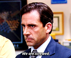
We showed up to the start point between 6 and 7pm. Cadre weren’t there, so we walked around a bit before they ended up arriving. After checking in, we went and grabbed dinner. Of all the races we’ve run, we were the most nervous before this one (even more so than before the 100-miler two weeks earlier that ended up taking us over 34 hours).
We’re used to knowing going in that we had no chance of winning and very little chance of not finishing. Due to the strange finishing times we’d found, we both felt that we had a nonzero chance of winning but also a big chunk of risk because there seemed to be something that we were missing.
1930: Team Sloth checked in.
1945: Whole Foods to grub up. Sushirrito and a big cookie for me, bread and hummus for Steve. Discuss how this is gonna be more stressful than Grindstone because we actually have expectations for this one, like, based on our prep and training run, and looking at the times for previous Star Courses this year, we think we have a chance of doing well.
Grindstone our only expectation was not dying. Which we made, but it was rough.
2015: Change for the race at/in the car. Running shorts, graphic layer, and a thermal layer for us both. Shoulder rucks and set off for the start point. We’re ready.
We picked up our rucks from the car and headed back to the start point, arriving around 8:15. Most people were there by that point, although 2 or 3 teams showed up during the briefing. The briefing was about what I’d expect. Paraphrased as “We’ll give you a list of points, you’ll go to them. If you drop, tell us. If you get hurt, not our problem (drop or call 911, as applicable). If you mess up the route planning, you are screwed and will fail.”
Well, maybe not cheat-cheat, but unlike, say, the JFK 50-Miler in Boonesboro, if you can find a way to hit all the waypoints while rucking fewer miles than anyone else? You’ll probably win. You know, instead of being disqualified for going off course.
In the end 31 teams with 99 total participants started. Waypoint lists were distributed to team leaders a hair after 9pm and it started.
2050ish: Brief begins. Notice on the scrolling marquee on the side of one of the skyscrapers that October is “National Liver Cancer Awareness Month”. Plans are made to get a picture of Steve shotgunning a beer in front of the sign at EndEx. Unfortunately, the sign isn’t on during the day.
2100: We receive packets. Pictures of waypoint hit-list are taken and sent to crew, and we start punching the coordinates into the route planner Steve coded up over the last couple of weeks. Then the route planner crashes. Oh, fuck. I keep typing them in to text over to Steve as soon as it’s back up and running.

One Heisenbug and one issue with Google Maps spitting back multiple locations when the city & state aren’t included later, which Steve managed to fuckin’ debug through his AWS console off of his smartphone while typing in the addresses, and we have our route.
I quickly typed the waypoints into AstroNav, with a couple near-heart attacks due to, first, a random website error that made it seem like it was broken (it wasn’t and reloading fixed it), and second, a database error due to me not specifying the city and state for a couple addresses (which required me to do some remote debugging on my phone, which is rough, but which didn’t actually require any fixes to the tool, just my inputs). Once everything was typed in, we had our route. 44.6 miles.
We set out running. Our dad later said that we were the only team that started by running, which is a bit surprising.

In retrospect, it may have been smarter to take our start-point picture at the beginning, but instead we saved it for the end. I can argue either way as to which is better, but it really only makes a difference if you end up neck and neck with another team.
Cadre didn’t really seem to care if we took our final picture or not, but like Steve said, if it came down to a neck-and-neck and the other guys had their picture while we were still snapping and posting ours, they’d have it and we’d be like… fuck. Part of it on our end, I think, was – especially after the initial hiccup – we wanted to get fucking moving.
Over to Steve for more of the technical details of his fuckawesome route planner:
I could write a lot about the technical aspects of the tool I built, but as I imagine the vast, vast majority of people reading this aren’t software engineers I’m going to mostly gloss over those. If anyone has questions or is interested in the specific code, infrastructure, deployment tooling, whatever, just let me know and I’m happy to talk far too much about all that (it’s literally part of my job). I don’t know what, if any, of his contact info he’d want thrown ’round willy-nilly, but he’s not exactly hard to find online (as in, if you can’t find him online, I’m unsure why you’re interested in those technical questions) and worst case I can put you in touch with him.
Anyway, AstroNav. It’s a serverless website running in AWS. It has a couple pages. First one takes in a list of addresses. When you submit that list, it calls Google Maps and asks for a route from the first to the last, hitting all the other ones in the middle in the shortest possible order. It tosses that in a database to minimize how frequently it calls Google, then returns a page that presents all that information.
That page has a couple useful things. Right at the top are the total route distance and Google’s projected time for that distance. It lists the waypoints in the recommended order; each one is a link to Google Maps to get directions to that location. At the end of the list is a link to open all of them as a multi-stop GMaps route, and after that is a button that lets you go to the “New Route” page, pre-populated with the waypoints in the current route. That makes it a lot easier to adjust on the fly, after you’ve completed some of them. Next up is a map that shows the route, and below that are the complete walking directions.
If you want to use the existing stack, go for it, although as previously mentioned it may change or disappear without notice as I keep working on it. If you want to spin up your own copy, feel free. All the code is on GitHub. It requires a bit of computering know-how but no actual code-writing, just button-clicking in the GitHub, Google, and AWS consoles.
And now back to timelined tomfoolery.
2110: Route is shown and described to Cadre Rob for final thumbs-up before leaving. We give a quick verbal brief (i.e., hit this stuff, go south, go north, come back). Cadre Rob pauses for a second (OMINOUS FORESHADOWING!!!), gives us the nod, and we start running.
Our planned route will take us looping through the center of Philly, hitting a few of the waypoints there, bouncing over the bridge into Camden (I start badly singing Morrissey at one point early on, to Steve’s well-justified displeasure) to hit the USS New Jersey, south to Fort Mifflin, north on the long stretch, and then hitting the last one or two objectives on our way back towards Paines Park and EndEx.
Waypoint: #rittenhousesquare 2018-10-19T21:26:09
We reach our first waypoint, Rittenhouse Square. Snap a picture, tag it and upload, and move out. We’re getting used to the navigation – the route finder gives us the order in which to hit the waypoints and hot links to Google Maps for each one, but there’s still a bit of bopping back and forth to get the actual on-the-ground turns and distances.
Waypoint: #lovepark 2018-10-19T21:36:35
2136: Second waypoint, Love Park. Pause for a bit crossing the grass square to help out another team – barely half an hour in, and they’ve lost all three pages of their hit list –

– so they snap some quick pictures of the three pages with the 18 waypoints on them. Hit our selfie, tag it, and move on.
Shortly before taking our picture at Love Park, we encountered another team that had lost their sheets and asked to photograph ours so they knew the waypoints. Don’t be like those guys (no offense).
I wasn’t gonna say it myself, but yeah, I agree with Steve. Heck, first thing we did was one person photographing them while the other typed the addresses up.
2130: Running along the streets, a couple of people notice our sloth rucks. One young lady is oblivious and walking along buried in her phone when she glances up and sees us. Startled, says that we scared her as we continue on by.
Now, we try not to, you know, power slide around corners with zero clearance, for example – take them wide, make sure not to be coming up behind people all Padfoot-ninja style, but it’s the city. Have some situational awareness. We aren’t literally shouting out “Heads up, GRTs comin’ thru!”, but we are two fast-movin’ dudes, wearing rucksacks with sloths strapped to ’em, adorned – literally – with blinking red lights.
In other words, we’re not exactly incon-fuckin’-spicuous, so if someone’s so zoned out they startle, we aren’t cringing.
Waypoint: #cityhall 2018-10-19T21:39:29
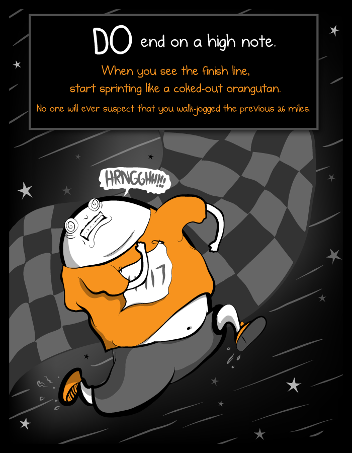
Third waypoint. City Hall. Right close – optimal route had us knocking out most of the waypoints in the first little bit, which we were fine with. Clear as much as possible right off, or ‘save’ the easier ones for morale boosting at the end? We’ll be running like coked-out orangutans in the home stretch regardless, so we figure that – in addition to this being the optimal route – we’ll be okay with some long movements to close it out.
The calculated route listed a couple waypoints immediately after Camden, but they were basically on the way so we decided to hit them first.
MOAR FORESHADOWING!!!
Waypoint: #firemanshall 2018-10-19T21:54:58
Fireman’s Hall Museum. Snap a picture, keep going. Not much to say here.
Waypoint: #elfrethsalley 2018-10-19T21:56:19
Elfreth’s Alley. Yeah, we weren’t moving that fast. Some of the waypoints really were that close together.
After that, we headed for the bridge, and, oops. The Philly-Camden pedestrian bridge is closed from 8pm to 6am. Our route would’ve worked just as well in reverse, saving that for near the end, but we didn’t know about the bridge closure. That cost us probably 5 miles.
Quick adjustment. Continue on with the preplanned course minus that one, then pick it up at the end. We head south, towards the stadium, hitting a couple more waypoints along the way.
Our original plan had been to hit up the bridge into Jersey in the first half to the USS New Jersey. Unfortunately, it turned out that the pedestrian walkway on that bridge is closed from 8PM until 6AM.
Okay, that’s… we can manage. A quick edit of waypoints, reroute, and we were back on the move.
Turns out that a lot of people got caught up by this, actually. So many people were posting about it that an email was sent out at midnight that, hey guys, the bridge is closed until morning. I’ll hit this one again at the end, as it was one of the two big “Lessons Learned” AKA “We Done Fucked Up”.
Waypoint: #oldcityhall 2018-10-19T22:11:09
Waypoint: #congresshall 2018-10-19T22:13:05
Like I said, close together.
Waypoint: #unknownsoldier 2018-10-19T22:16:41
Washington Square – Tomb of the Unknown Revolutionary War Soldier. Hats off. The first one of our “Is that Cadre?” ‘sightings’ – not actually Cadre, just a couple chilling in the park, by the flame. They remark that it’s a chilly night – we shrug. Kinda toasty and sweaty, the pace we’ve been moving.
Are we doing a scavenger hunt? Kinda.
How far? About five and a half miles so far.
Wow!
(Only forty or so more to go, we think.)
Waypoint: #magicgardens 2018-10-19T22:24:29
Starting the next long semi-straightaway, passing the Magic Gardens. Ironically enough, right here is about where the streets of downtown Philly stop smelling like skunk weed.
Waypoint: #italianmarket 2018-10-19T22:29:41
And five minutes later, the Italian Market. About eighty minutes in, and we’ve hit ten out of the eighteen waypoints. (Really 17, since one of them is Paine’s Park and EndEx.)
Waypoint: #genossteaks 2018-10-19T22:33:38
2233: Geno’s Steaks! The counter guys chuckle at us. Probably used to people taking pictures at Geno’s, but not usually wearing rucksacks with sloth-skin covers, running by at ten-thirty on a Friday night.
We did not get cheesesteaks. Steve’s a vegetarian and I decided that gastrointestinal discretion was the better part of valor. Chocolate donuts and dried dates for me – the cornerstone of any nutritious breakfast!
Up to this point we’ve been mostly running, with a couple brief power-walking breaks. Add a bit more walking once we start the final stretch towards the stadium.
Waypoint: #phillyeagles 2018-10-19T23:00:20
Lincoln Financial Field. Not a big football fan, so… It was a stadium.
After the stadium, plug in the remaining addresses. Route still has us hitting Camden before 6am, so another manual adjustment (although not for a couple stops). Head south to Fort Mifflin. There’s a long bridge; we hit a convenience store right before that and take the walk up the bridge as an opportunity to digest some food. Crossing the bridge is a bit rough if you’re afraid of heights (luckily I’m not).
I am. Wind whipping, cars shooting by, it’s kinda jangly on the nerves. One foot in front of the other, just like Cadre said. Head down, eyes down, keep trucking, and then the cement walkway turns into mesh grating.

After the bridge, loop around a bit (we could’ve cut a fraction of a mile off here by cutting a corner through some trees, but didn’t realize it until we were on the other side). Follow some industrial-ish roads, until my phone says we’re there. We definitely aren’t, as we’re outside some mill-ish complex and the road ahead of us is flooded and stagnant.
Intentionally non-detailed side note at this point: We’re moving slower than usual around this point due to both of us having GI issues.
Pull up satellite photos of the area.
Apparently Fort Mifflin Rd is one of those roads that has two non-connected sections, and it sent us to the wrong one. How long to get to the other? According to Google, about 10 miles.
I don’t say this (random aside: withholding navigational details and/or straight-up lying about route distance or pacing can be crucial at times during long races) (in this particular instance I remember him saying that it would be nine-some miles, and we mutually agreed quote “fuck that noise”, but regardless, he’s right) and just ask Don if he’s cool cutting across-country.
He says yes, we head on into the water. Luckily it isn’t deep, and most of our open wounds from previous races are healed at this point. Eventually that leads to a railroad track, which leads to a road. Follow that, and about a mile from where Google led us we hit the fort.
Waypoint: #fortmifflin 2018-10-20T00:48:19
Fort Mifflin. …And right on the heels of the bridge to Jersey, here’s the other one of our primary fuck-ups, AKA “Another Lesson Learned”. Basically, double-check the street address against the Famous Location Name, just to be sure. Especially if it’s in the middle of fuckin’ nowhere.
Our second false Cadre alarm – we see a dude next to his car, cell phone on, and I’m ready to shout out “Hey, are you the Uber we called?”, but on getting closer we realize he’s just a random dude. Hopefully he was crewing for someone, ’cause otherwise he’s just a dude having a smoke at one AM in front of an active military installation in the middle of nowhere.

Take picture, post, pull up directions for the next waypoint (College Hall). Google again says to take a long, circuitous route, so it’s back cross-country. Once we’re to the original road, pull up directions and head out.
As we’re heading back to the main-ish road, pass another couple GRTs going to the same wrong address we headed for. Exchange greetings. If they’d asked about directions we would’ve given them advice about the GMaps address issue. But…
After hitting the main-ish road, Google sends us onto a small road to cut off a larger, looping turn. Unfortunately, only half of the road exists, the rest is a fenced parking lot. On the other side (our right), there’s another fenced industrial complex. We’re doing our best to not climb any fences, so instead we follow the gap between the two. Eventually the fence on the left ended and we cut up to the road we needed.
More rucking/jogging. It’s been drizzling a couple drops but now it starts raining, lightly but more consistently. Eventually reach the college, only having to take one small detour around a closed road section.
Waypoint: #collegehall 2018-10-20T02:56:13
College Hall. It was raining now, and while we’d seen a couple of groups of students with backpacks, we hadn’t seen any GRTs since way early on. It was still in the low-mid fifties, and we both had a thermal layer, so the conditions weren’t worrisome, just less pleasant than they could have been. Whatever.
Take picture with Ben and then hop onto the porch (for lack of a better term) of one of the adjacent academic buildings to plan our next steps. The places that remain are the covered bridge, Camden, the jail, and the end. The jail and end are about a half-mile apart, so treat them as one. Next stop is the bridge, as we’d be hitting the bridge too early if we headed to Camden right now. It’s a long slog (we guesstimate that it’ll take us between 2 and 3 hours), so we call our dad and ask him to meet us there so we can grab some morale cookies and dry clothes.
Head out from Ben, and quickly see some ruckers on the other side of the road headed towards the college. Call out to them, they don’t seem to notice. Whatever.
Stop by 7-11 for some water and calories. I primarily relied on Gatorade for this race, with a handful of Oreos and a couple dates. Don fueled up with dates and donuts, grabbing a couple of the latter at this stop.
Yeah, I had most of a 12 oz package of dates, two chocolate-glazed donuts, a double-chocolate cake donut, one of those little packs of mini-chocolate shell donuts, and about a gallon of water during the event, along with some ibuprofen etc. and two packs of caffeinated gum.
As we’re heading out, we see another group of ruckers headed towards the college. Don waves to them with a donut, they look miserable.
Like I said above, the conditions weren’t bad, just a bit uncomfortable. There’s really no way to do fifty-plus miles on foot, rucking or running, without it being miserable. And if you somehow aren’t miserable, that means that you can go faster. Basically, there’s “it’s thirty-three degrees and raining and if I don’t do something I’m gonna be in trouble”, and there’s “this kinda sucks”. When it comes to sucky weather like that, just general non-injurious ‘suffering’? Go for the wrench.
Weather sucks, it’s cold and rainy and not fun? Awesome! Why? ‘Cuz fuck the weather, that’s why.
We head for the bridge. Long slog of a couple several-mile legs. We pass one group along the way, they were headed south on the other side of the road. Conveniently we happened to be jogging at that point and they complimented us, although that overall leg of the journey was probably at least half walking.
Somewhat unexpectedly, the directions drop us onto a downhill single-track trail. We stumble down (the only time during the event that we actually needed to use a headlamp for path illumination instead of keeping us visible) and hit a gravel road. A couple miles left, we keep going.
Both of us independently start to get concerned that this isn’t actually a road that cars have access to, at least the part of it near the bridge. It isn’t until we get to the bridge and, yep, nobody waiting for us, that Don notices a missed call from an hour before. Oops.
Waypoint: #thomasmillbridge 2018-10-20T06:33:38 (taken at 5:47, but couldn’t post for a while)
Thomas Mill Bridge. We quickly figure out what happened with our crew – my phone had gone into Silent overnight (I usually try to go to bed at about the time we started running yesterday), and I hadn’t looked at it since the land nav. at Fort Mifflin. A little bit of Prisoner’s Dilemma thinking goes down – we assume that our crew would know that we’re okay, and if we really weren’t okay, then we’d manage. It’s not like we’re ten miles from the nearest aid station, in the middle of the forest, temperatures at 90, and we drank our last water two miles back.
Lookin’ at you, this-year’s-UROC.
We’d been planning on maybe some dry clothes (just for morale), and a cookie or two (likewise), but we hadn’t been counting on anything. We both still have food in our packs and we’ve passed an open restroom near the visitors’ center if we need water, so time to keep on keepin’ on.
We take the picture and, inconveniently, can’t post it, as we have no service. Keep checking every once in a while as we head back along the gravel road, and eventually get a signal around when we hit a real road. Post the picture, call crew, say that we’ll meet them at the end, and start heading for Camden.
I believe that my exact quote to our crew when they asked if we were okay, if we wanted them to meet us somewhere later on, was “We’ve got food, we’ve got water, we’ve got sonic-electronic ball breakers! I think we’re good.”
The next stretch coming back takes us through, among other areas, Allegheny West and Strawberry Mansion.
Not really, but these two neighborhoods were… kinda rough. Cadres’ strong suggestion that if you were continuing on alone after the rest of your team dropped to join up with another group makes much more sense. (Note that my ever-so-scientific evaluation was thinking “Wow, lotta run-down vacants” along the course, and then looking at the first Google result for “philadelphia ghetto” just now. Those two are #3 and #5, respectively.)
Mix of walking and jogging, with all the hills walked (for the entire course, but especially here) and the vast majority of the downhills jogged. Hit the bridge, and thankfully it’s open now. Walk the long uphill to the top, start jogging down.
If I remember correctly, somewhere along the bridge we pass another group of ruckers headed the other direction. Once down the other side and under to the south side of the bridge, we head for the battleship. Pass a group of ruckers headed back from the ship. Get to the battleship, take our picture, turn around.
Yeah, we passed a couple of groups of ruckers coming back. Nods and brief waves, and then in a fit of late-race ebullience I bellow out “What ho, fellow weirdos!” and am met with, understandably, some bemusement.
And similar to the earlier bridge, fuck New Jersey’s side of the bridge. Everything’s fine until the last downhill, where it goes from a nice paved sidewalk to a fuckin’, sheets-of-steel-slapped-down-on-a-single-width-construction-path piece of shit. Like, you can feel them rattling under your feet as you jog, you have to squeeze sideways to let a runner come through the other way, there are sizable gaps on either side over the bare girders, just… fuck.
I optimistically think that maybe it’s a temporary construction measure? Steve reminds me that it’s fuckin’ New Jersey, so… fifty-fifty?
Waypoint: #ussnj 2018-10-20T09:11:52
USS New Jersey. We take our picture next to the ticket booth and then scoot back towards Philly. We’re not gonna go overboard on the zoom and snap our pic as soon as we have an unobstructed line of sight to the ship, but we aren’t going to wait in line and buy a ticket to get a hundred yards closer, either.
Try to cut diagonally across a parking lot; didn’t realize it only had an open gate at one corner and not the opposite one. Managed to fit under the closed gate, so our goal of not climbing fences managed to hold.
Jogged most of the way back to the bridge, then walked the uphill and refuelled for the final “coked-out orangutan” (as Don puts it) phase of the race.
Hit the top, start jogging. We pass the last ruckers we’d seen right at the bottom of the bridge.
To keep spirits up on the final push, i.e. to give Steve something to be angrier at than the last few miles of running, I start up a cadence. Not, like, a good cadence, like… “Look-at-this, moth-er-fucker, on-our-bridge, wearing-a-hat, with-flappy-ears, how-dare-he, let’s-catch-him, an’then-those-other, moth-er-ruckers, way-up-ahead, why-are-theywalking, don’t-they-know, this-is-arace…” And, yeah, it went on like that.
Jog right on 5th, walk/jog left on Callowhill and call our crew to tell them that we’ll be finishing in a little bit.
I hang up quickly, because I really don’t want to hear something like “Cool, the Cadre said that X Team is five minutes away!”, or “The teams here are cheering you on!” or something like that. If it is, it is, but no distractions.
Turn right on Ridge. There’s another group of ruckers headed the same direction as us, on the opposite side of the street. We really don’t want to lose at this point. It’s entirely possible that someone else finished ahead of us already, but we are not about to let another team beat us when it’s this close with a mile left without working for it.

We pick up the pace, and this is possibly the only place on the course where we run up a hill. Gain a couple-block lead by the time we hang left onto Fairmount.
There was a union block party in the middle of this stretch, which helped. We’d crossed the street and were weaving around the cars pulled up onto the sidewalk, and the other team – it looked like – had to wend their way through a solid block of orange-sweatshirted Teamsters. (Note – I don’t think they were actually Teamsters, but AFL-CIO.) I.e., big people you didn’t want to just shove past.
Four blocks or so to Eastern State Penitentiary, the last intermediate waypoint. I pull up directions to the endex on my phone and get Instagram ready to minimize the time we need to spend static at the jail.
Waypoint: #esp 2018-10-20T10:19:26
Eastern State Penitentiary. We were marking down the street numbers, bobbing around dog-walkers on the sidewalk… I was chanting, at one point, “Do lots of coke, all the cocaine” alongside “Pain don’t hurt, suffering is a choice.”
Stop, take picture, quickly post, run. It’s six-tenths of a mile to the end, pretty much all downhill. Maximum effort.
Turn left off Fairmount onto some street whose name I don’t remember at this point, pick up the pace as the downhill slope increases. Once we hit the couple big roads right before the end, pause briefly to let cars go by but otherwise sprint across. See a couple groups of people between us and the finish, and can’t entirely tell who they are so we keep up our pace. Cross the last street, hit the final parking lot, hastily take our final waypoint picture. It takes me far too long to post because I’m sweating heavily at this point from the final sprint and the saltwater is making my phone’s screen not register touches. Eventually dry it off and get the photo posted, although by that point the cadre didn’t seem to really care. All the while, keeping an eye across the street for when the team that was right behind us will arrive. Our official finishing time was 10:24 as that’s when we got to the park, although it took a couple minutes for me to get the photo posted.
Waypoint: #painespark 2018-10-20T10:26:04
It isn’t until they hand us the gift certificate that we learn we were the first finishers, although we had a bit of an inkling given that they opened a fresh plastic-wrapped pack of finisher patches as we were posting our final picture.
Get our patches, get our picture taken with the flags.

At this point we can finally relax. Still wondering where the team that was close behind is. Sit down, check Instagram, start trying to figure out where the other teams are. Finally realize that the team right behind us still has quite a hike left; they haven’t yet hit the covered bridge, among other places.
We eat the morale cookies we were initially planning on having at the bridge. May or may not have some other morale-related beverages. Wait around for a while, pet the Belgian Malinois someone brought along. Try to figure out from Instagram when the second-place team will arrive. It looks like it’ll be a while. After waiting for an hour and a half or so we head out sometime around noon; I would’ve liked to stay longer but I had to catch a flight to London for a conference the following morning at 8am, several states away.
Yeah, from the reception we had – back slaps and congratulations, I thought we’d done well, and I noticed that Cadre Flash cracked open a fresh pack of patches, but I wasn’t sure and I wasn’t going to blurt out “Did we win!?” because, yeah. No. Even then, it wasn’t until we saw the amount on the gift certificate certificate that it sunk in that, yup.
It turned out that after our last call to our crew, they headed over to endex and let the Cadre know that we’d be coming in within the next few minutes, and that was when they got the flags set up and ready for the finish. Of course, on that last downhill, we can make out the flags and the finish point, but there was a lacrosse team practicing on the field next to the parking lot, so we just see a bunch of big people wandering around, piles of gear on the ground, and my thought process goes “Shit, they’ve finished already!” to “Wait, maybe they… dropped? And came back here to chill?” and finally “Fuck it, irrelevant – RUN!”
Second team finished at 12:52, third at 13:56. They had the most stressful finish, I imagine; the fourth, fifth, and sixth teams had recorded finishing times of 13:57, 13:58, and 13:59. Of the 31 teams that started, 23 teams and 62 participants finished.
Steve’s Advice
Someone messaged us on Instagram while we were headed home asking what 3 pieces of advice we had on the event. My response was limited by Instagram’s message size limits, but here’s a slightly longer version of our response:
1. Use the best route planner you can find. We couldn’t find one that we liked (they were all driving-focused, not for foot travel) so I built https://astronav.drunkenrobotlabs.org and it gave us a route about 8 miles shorter than the cadre thought was possible (44.6 vs ~53, although we messed up and ended doing around 53 anyway). Also double-check parts of the route that are tough to change on the fly. In our case, the bridge being closed at night cost us at least an hour in extra route distance. If there are any places like that where you won’t be able to easily bypass a closed road, make sure the road isn’t closed before you head there, if possible.
2. Run slowly, don’t ruck quickly. Also run a bunch as training. A hilly hundred-miler makes a weighted 50-miler feel easy by comparison. We also practiced by running a 12-hour race with our rucks last month. Note: This only holds true for 10/20 pounds. I wouldn’t recommend running this distance with a 30/40 pound ruck. I ran a 10-miler with a 40lb sandbag last year and my knees complained for weeks.
3. It’s going to hurt, and the only way to make that end is finishing. Quitting stops the physical pain but just replaces it with emotional pain, so don’t even think about doing that unless you have an injury that would be made seriously worse by continuing. (All that said, painkillers also help. I think I took four ibuprofen and four Excedrin over the course of the race.)
Don’s Advice
Overall, I’d say that our finish was maybe 50% route planning, 40% base running, and the last 10% mental or attitudinal. Most of my advice is the exact same as Steve’s, and not just because we tossed ideas around on the drive back when we weren’t sleeping or stuffing our faces.
The two specific “Lessons Learned” AKA fuck-ups we had were the bridge to Camden and Fort Mifflin. Steve said to double-check parts of the route that would be hard to change on the fly, and I’d add to that to double-check any part of the route that is impossible to bypass. For example, we fucked up the address of Fort Mifflin, but we were able to cut cross-country to make up for it. The bridge to New Jersey, though, that’s a single point of failure with no chance of working around it, so we should’ve checked that more thoroughly.
With Fort Mifflin, it was… well, it was out a ways from the city. Out in the country, road numbers can be interesting. For stuff outside the city proper, we should have double-checked to make sure that the street address and the landmark name return the same geographical location. We should have done that for the covered bridge, too, but we got lucky there. (Possibly because it’s technically at least sorta on a road-road, though it was hard to tell for sure around 0500.)
Anyways, full advice?
1. Plan your route. Under a ruck, running, your mid-course pace will probably be no faster than 12 minutes a mile. (And if your base/core/predominant pace is faster than 12 minutes per mile during a 20# ruck, then sure, you might want to judge.) [PENNY ARCADE] So if it takes an extra ten minutes of planning to shave a mile off your route, that’s a net win. Be comfortable navigating on the fly, going cross-country if you have to. You’re required to have a mobile phone, you’re required to be online. Be ready to whip out some satellite imagery and dead-reckon if you have to. Double-check critical points of failure.
2. Run. A lot. This year Steve and I have run… let’s see, Bel Monte (50-miler) in March, Promise Land (50k+) in April, UROC (100k) in May, Old Dominion (100-miler) in June, nothing in July and August (we kept running and working out, of course, just no ultramarathons), the 12-Hour ATR in September (~45 miles, with rucks), and then Grindstone (100-miler) the first weekend in October. And last year we did at least one ultra (50k+) each month.
I’d put in a little over 2,200 miles this year coming into the Star Course, which is definitely more than anyone would “need” if they were preparing specifically for an event like this, but apart from adding the rucksack every now and then, Steve and I more or less relied on that base mileage for our preparation.
Now for the huge caveat – running with 10/20 pounds deadweight is totally different than running with 30/40 pounds. This whole “run, don’t ruck” advice is very specific to this weight. As Cadre Flash said, his daughter rucks more than that to school each morning. Like Steve said, we’ve both run with 40# rucks, at only a slightly faster pace, and ten miles of that is murder. Ironically enough, I think that my wearing VFFs helps here – I’ve been sore as fuck after a 40# ruck run, but I haven’t felt it in my joints, presumably because, wearing VFFs, if I were relying on my joints instead of muscles for impact absorption, I’d be well crippled by now.
If it were 40#, or more, we absolutely would have approached this differently in terms of both training preparation and day-of race strategy & tactics.
3. It sucks. It’s going to suck. From ultrarunning, there are books and books of shit like this, about pushing through pain and discomfort, but, basically, just keep in mind that:
David Horton – “It never always gets worse.”
Zig Ziglar via Cadre (I think; third-hand) – “The chief cause of failure and unhappiness is trading what you want most for what you want right now.”
And as Steve said, remember that it ends. And the faster you run, the sooner it’ll be over.
On a more practical note, because if you’re an ultrarunner this is familiar and if you’re a GRT it’s super familiar, this is one of the huge benefits of the super-long runs for me with regards to an event like this.
For some reason, I’ve no idea why, about a third of the way into pretty much every ultra I run, I hit a “dark night” moment. I realize just how utterly fucking silly and stupid and nonsensical it is that I’ve just run 10, 20, 30 or more miles, that I have twice that still to go, that I might be running for a literal day yet, and – just why? WHY ARE YOU DOING THIS TO YOURSELF?
It usually goes away after a couple of miles, either just drifting off or getting pounded and worried and ripped into shreds from banging my head against it, but the important thing is that I know that it’s coming. It hits, I look at my watch and think, yup, right on time.
The relevance of this is, if I don’t know that it’s coming, then 16, 17 miles into the Star Course would put it right at the witching hour, middle of the night, it’s cold and rainy and you’re starting to ache and if you run into this sort of shit then that’s an extra kick in the throat that you do not need.
But seeing as this is already over seven-fuckin’-thousand words between the two of us, rather than going on longer about mindset and how it’s easier to quit something like this, where there’s no peer-pressure-of-strangers over your shoulder, no log in the air; because first of all (barring, obviously here, injury, and even then, if it’s not life-threatening, fuck it – keep going, and let Cadre text asking where the fuck you are at the twenty-hour mark, even if you’re on goddamn crutches from a CVS) even talking about how not to quit is dangerous because you’re still talking about quitting, and secondly before I embarrass us all, here’s your TL;DR:
Star Course Advice:
- Plan your route – don’t go one mile more than you have to.
- Prep your cardio – it’s a weighted run, not a fast ruck.
- Have your mind right.
Random Gear Shots:
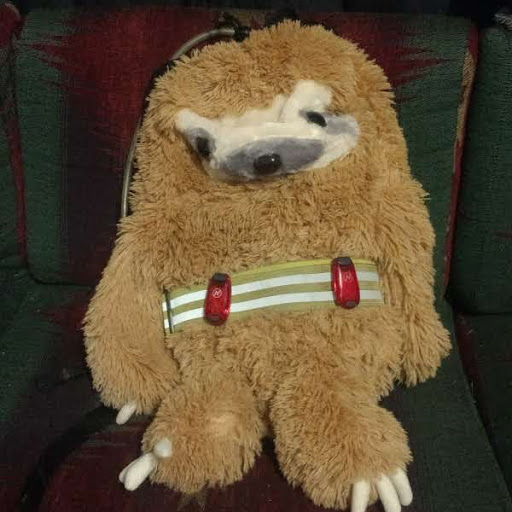
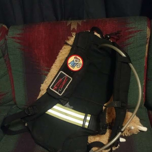
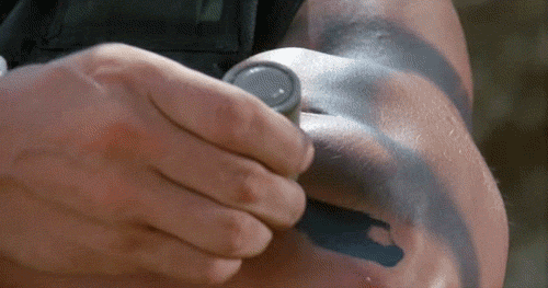
I had a 10L Bullet with sternum strap and a reservoir-hose retainer, PT belt and couple of blinkers, and a MOLLE phone pouch. Inside was the weight plate, a 1.5L reservoir, snacks, gum, miscellaneous supplies. Steve can add his if he wants, but I think the only real differences were he used a 5L with a half-filled 3L reservoir, and he didn’t skin his sloth.
-Also had a USB battery and a long cable so I could recharge my phone while still using it for directions.
Raw info (i.e., some stuff I wished I’d had from previous events to help with prepping):
Here are the addresses given on the list at the start, in the order they were printed.
Paine’s Park, Martin Luther King Jr. Drive & Benjamin Franklin Parkway (#painespark)
Eastern State Penitentiary, 2027 Fairmount Ave (#esp)
LOVE Park, Arch St (#LOVEpark)
Lion w/ Snake, Rittenhouse Square, 1848 Walnut St (#RittenhouseSquare)
Philadelphia City Hall, 1400 John F Kennedy Blvd (#cityhall)
Ben Franklin at College Hall, University of Pennsylvania (#CollegeHall)
Congress Hall, Chestnut St & South 6th Street (#CongressHall)
Tomb of the Unknown Revolutionary Soldier, Washington Square (#unknownsoldier)
Magic Gardens, 1020 South St (#magicgardens)
Old City Hall, Chestnut St & South 5th Street (#oldcityhall)
Fireman’s Hall Museum, 147 N 2nd St (#firemanshall)
Elfreth’s Alley, 124-126 Elfreth’s Alley (#elfrethsalley)
The Italian Market, South 9th Stret Curb Market (#italianmarket)
Geno’s Steaks, 1219 S 9th St (#genossteaks)
Battleship NJ, 100 Clinton St, Camden, NJ (#USSNJ)
Lincoln Financial Field, 1 Lincoln Financial Field Way (#phillyeagles)
Thomas Mill Covered Bridge, 8901 Forbidden Dr (#thomasmillbridge)
Fort Mifflin, 1 Fort Mifflin Rd (#fortmifflin)
Google gives an optimal course of either 44.6 or 58.3 miles, depending on whether Fort Mifflin is entered as “Fort Mifflin, Philadelphia, PAFort Mifflin, Philadelphia, PA” (58.3 miles), or “1 Fort Mifflin Rd, Philadelphia, PA” (44.6 miles). The 44.6-mile course doesn’t actually go to Fort Mifflin; it gets close but then requires about a mile each way of overlanding (that doesn’t require hopping any fences or passing any “No Trespassing” signs, although it does feel a bit sketchy). So, optimal route not counting corner-cutting at certain turns (which is completely fine, just tough to calculate), is probably between 46 and 47 miles.
Here’s a link to my GPS of our route (which has errors, because my watch isn’t great, but gives the general picture).

Can’t believe that team lost their hit list! The first thing we did was all took pictures in case someone dropped and ran off with the list.
LikeLike
[…] [2018] Star Course – 50 Miler (Philadelphia) […]
LikeLike